
Thank you for supporting this site ❤️
Make a donation
Make a donation
Stueng Trang topographic map
Click on the map to display elevation.
Thank you for supporting this site ❤️
Make a donation
Make a donation
About this map
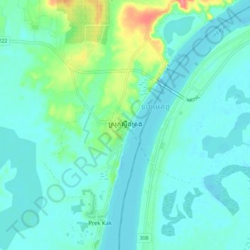
Name: Stueng Trang topographic map, elevation, terrain.
Location: Stueng Trang, Kampong Cham, Cambodia (12.21718 105.49884 12.29718 105.57884)
Average elevation: 19 m
Minimum elevation: 5 m
Maximum elevation: 81 m
Thank you for supporting this site ❤️
Make a donation
Make a donation
Other topographic maps
Click on a map to view its topography, its elevation and its terrain.