
Cholistan desert topographic map
Interactive map
Click on the map to display elevation.
About this map
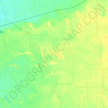
Name: Cholistan desert topographic map, elevation, terrain.
Location: Cholistan desert, Chishtian Tehsil, Punjab, Pakistan (29.58191 72.48208 29.68470 72.78202)
Average elevation: 147 m
Minimum elevation: 138 m
Maximum elevation: 158 m
Other topographic maps
Click on a map to view its topography, its elevation and its terrain.
Park
Pakistan > Punjab > Lahore District > Keer
Park, Ali View, Keer, Lahore District, Punjab, Pakistan
Average elevation: 215 m
Ghangian Wali
Pakistan > Punjab > Ghangian Wali
Ghangian Wali, Siālkot District, Punjab, Pakistan
Average elevation: 247 m
Chenab River
Chenab River, Gujrānwāla District, Punjab, 35460, Pakistan
Average elevation: 507 m
Bahawalpur
Pakistan > Punjab > Bahawalpur
Bahawalpur, Bahāwalpur District, Punjab, 63100, Pakistan
Average elevation: 118 m