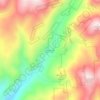
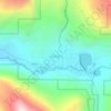
Mount Crested Butte topographic map
Click on the map to display elevation.
About this map

Name: Mount Crested Butte topographic map, elevation, terrain.
Average elevation: 2,949 m
Minimum elevation: 2,703 m
Maximum elevation: 3,631 m
Other topographic maps
Click on a map to view its topography, its elevation and its terrain.
Monarch Pass
United States > Colorado > Gunnison County
Monarch Pass (elevation 11,312 feet (3,448 m)) is a high mountain pass in central Colorado, in the Rocky Mountains of the western United States.
Average elevation: 3,419 m
Crystal
United States > Colorado > Gunnison County
The elevation of Crystal is centered at 8,950 ft (2,728 m), however the area in and around crystal ranges from 8,500 ft (2,590.8 m) to peaks of 13,500 ft (4,114.8 m). The land is well drained, and the rock types, such as limestone, create very steep slopes, common in the Rocky Mountains. The area is described…
Average elevation: 3,146 m





Crested Butte
United States > Colorado > Gunnison County
Crested Butte is located in north-central Gunnison County on the west side of the valley of the Slate River, along Coal Creek. Colorado State Highway 135 runs south from Crested Butte 27 miles (43 km) to Gunnison, the county seat. According to the United States Census Bureau, the town of Crested Butte has a…
Average elevation: 2,798 m