
Thank you for supporting this site ❤️
Make a donation
Make a donation
Isernia topographic map
Click on the map to display elevation.
Thank you for supporting this site ❤️
Make a donation
Make a donation
Isernia
The commune of Isernia includes 16 frazioni. The most densely populated is Castelromano which is positioned in a plain at the base of the La Romana mount, elevation 862 metres (2,828 ft), 5 kilometres (3 mi) from Isernia.
Thank you for supporting this site ❤️
Make a donation
Make a donation
About this map
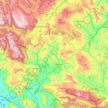
Name: Isernia topographic map, elevation, terrain.
Location: Isernia, Molise, Italy (41.38743 13.94102 41.91176 14.52225)
Average elevation: 886 m
Minimum elevation: 16 m
Maximum elevation: 2,273 m
Thank you for supporting this site ❤️
Make a donation
Make a donation
Other topographic maps
Click on a map to view its topography, its elevation and its terrain.