
Thank you for supporting this site ❤️
Make a donation
Make a donation
Spigno Monferrato topographic map
Click on the map to display elevation.
Thank you for supporting this site ❤️
Make a donation
Make a donation
About this map
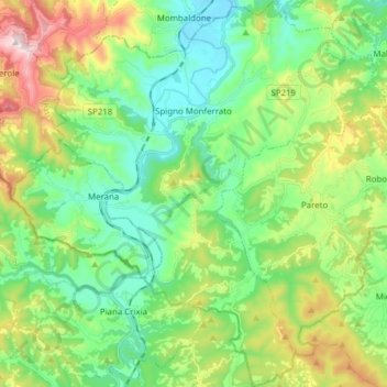
Name: Spigno Monferrato topographic map, elevation, terrain.
Location: Spigno Monferrato, Alessandria, Piedmont, 15018, Italy (44.46472 8.27823 44.57455 8.41079)
Average elevation: 397 m
Minimum elevation: 201 m
Maximum elevation: 839 m
Thank you for supporting this site ❤️
Make a donation
Make a donation
Other topographic maps
Click on a map to view its topography, its elevation and its terrain.