
Make a donation
Angat Dam View Deck topographic map
Click on the map to display elevation.
Make a donation
About this map
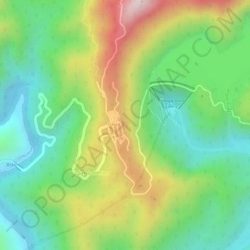
Name: Angat Dam View Deck topographic map, elevation, terrain.
Average elevation: 230 m
Minimum elevation: 59 m
Maximum elevation: 484 m
Make a donation
Other topographic maps
Click on a map to view its topography, its elevation and its terrain.
Ipo Dam
Philippines > Bulacan > Norzagaray > Ipo
The spill level of the dam is at an elevation of 101 metres and it has seven radial floodgates. The watershed topography is characterised by mountainous terrain similar to the Angat Reservoir Watershed with moderate forest cover. The watershed has an area of about 70 square kilometers and receives an average…
Average elevation: 174 m
Make a donation