
Thank you for supporting this site ❤️
Make a donation
Make a donation
Whittington topographic map
Click on the map to display elevation.
Thank you for supporting this site ❤️
Make a donation
Make a donation
About this map
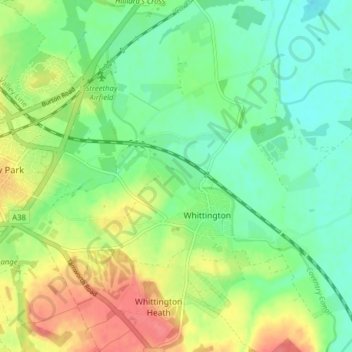
Name: Whittington topographic map, elevation, terrain.
Location: Whittington, Lichfield, Staffordshire, England, United Kingdom (52.65556 -1.80503 52.70314 -1.74408)
Average elevation: 70 m
Minimum elevation: 47 m
Maximum elevation: 107 m
Thank you for supporting this site ❤️
Make a donation
Make a donation
Other topographic maps
Click on a map to view its topography, its elevation and its terrain.
Fulfen Wood
United Kingdom > England > Staffordshire > Lichfield > Whittington > Streethay
Average elevation: 69 m