
Thank you for supporting this site ❤️
Make a donation
Make a donation
Ain Merane topographic map
Click on the map to display elevation.
Thank you for supporting this site ❤️
Make a donation
Make a donation
About this map
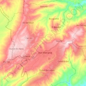
Name: Ain Merane topographic map, elevation, terrain.
Location: Ain Merane, Aïn Merane District, Chlef, Algeria (36.11533 0.90729 36.23577 1.02873)
Average elevation: 426 m
Minimum elevation: 133 m
Maximum elevation: 634 m
Thank you for supporting this site ❤️
Make a donation
Make a donation