
Legana topographic map
Click on the map to display elevation.
About this map
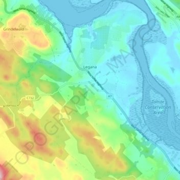
Name: Legana topographic map, elevation, terrain.
Location: Legana, Launceston, West Tamar, Tasmania, Australia (-41.41207 147.00299 -41.33522 147.07797)
Average elevation: 82 m
Minimum elevation: -2 m
Maximum elevation: 314 m