
Thank you for supporting this site ❤️
Make a donation
Make a donation
Kulassian Island topographic map
Click on the map to display elevation.
Thank you for supporting this site ❤️
Make a donation
Make a donation
About this map
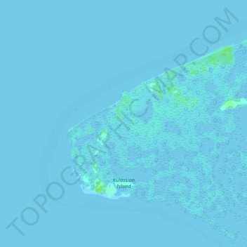
Name: Kulassian Island topographic map, elevation, terrain.
Location: Kulassian Island, Pangutaran, Sulu, Bangsamoro, Philippines (6.39721 120.66705 6.43736 120.71574)
Average elevation: 0 m
Minimum elevation: -2 m
Maximum elevation: 9 m
Thank you for supporting this site ❤️
Make a donation
Make a donation
Other topographic maps
Click on a map to view its topography, its elevation and its terrain.