
Thank you for supporting this site ❤️
Make a donation
Make a donation
Bugaan West topographic map
Click on the map to display elevation.
Thank you for supporting this site ❤️
Make a donation
Make a donation
About this map
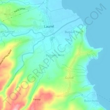
Name: Bugaan West topographic map, elevation, terrain.
Location: Bugaan West, Laurel, Batangas, Calabarzon, 4221, Philippines (14.02011 120.91553 14.06011 120.95553)
Average elevation: 47 m
Minimum elevation: 4 m
Maximum elevation: 181 m
Thank you for supporting this site ❤️
Make a donation
Make a donation