
Le Sérac topographic map
Interactive map
Click on the map to display elevation.
About this map
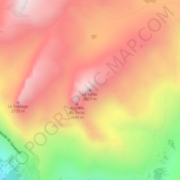
Name: Le Sérac topographic map, elevation, terrain.
Location: Le Sérac, Savièse, Sion, Valais, 1965, Suisse (46.32604 7.32960 46.32614 7.32970)
Average elevation: 2,400 m
Minimum elevation: 1,702 m
Maximum elevation: 2,838 m
Other topographic maps
Click on a map to view its topography, its elevation and its terrain.
Becca d'Audon
Suisse > Valais > Sion > Savièse
Becca d'Audon, Savièse, Sion, Région administrative de l'Oberland, Valais, 1965, Suisse
Average elevation: 2,606 m