
Thank you for supporting this site ❤️
Make a donation
Make a donation
Pangari Kh topographic map
Click on the map to display elevation.
Thank you for supporting this site ❤️
Make a donation
Make a donation
About this map
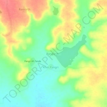
Name: Pangari Kh topographic map, elevation, terrain.
Location: Pangari Kh, Mantha, Jalna, Maharashtra, India (19.66313 76.40920 19.70313 76.44920)
Average elevation: 476 m
Minimum elevation: 446 m
Maximum elevation: 510 m
Thank you for supporting this site ❤️
Make a donation
Make a donation
Other topographic maps
Click on a map to view its topography, its elevation and its terrain.