
Thank you for supporting this site ❤️
Make a donation
Make a donation
Crystal Mountain topographic map
Click on the map to display elevation.
Thank you for supporting this site ❤️
Make a donation
Make a donation
About this map
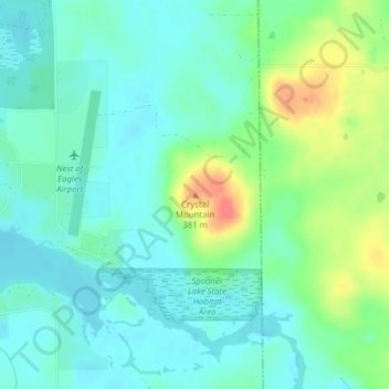
Name: Crystal Mountain topographic map, elevation, terrain.
Average elevation: 344 m
Minimum elevation: 328 m
Maximum elevation: 384 m
Thank you for supporting this site ❤️
Make a donation
Make a donation
Other topographic maps
Click on a map to view its topography, its elevation and its terrain.
Beartrap Lake
United States > Wisconsin > Washburn County > Town of Birchwood
Average elevation: 431 m
Thank you for supporting this site ❤️
Make a donation
Make a donation