
Thank you for supporting this site ❤️
Make a donation
Make a donation
Skardhaugen topographic map
Click on the map to display elevation.
Thank you for supporting this site ❤️
Make a donation
Make a donation
About this map
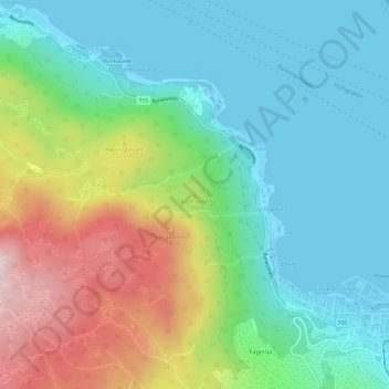
Name: Skardhaugen topographic map, elevation, terrain.
Location: Skardhaugen, Trondheim, Trøndelag, 7018, Norge (63.43937 10.33800 63.43947 10.33810)
Average elevation: 117 m
Minimum elevation: -19 m
Maximum elevation: 378 m
Thank you for supporting this site ❤️
Make a donation
Make a donation
Other topographic maps
Click on a map to view its topography, its elevation and its terrain.