
Thank you for supporting this site ❤️
Make a donation
Make a donation
Simisa Island topographic map
Click on the map to display elevation.
Thank you for supporting this site ❤️
Make a donation
Make a donation
About this map
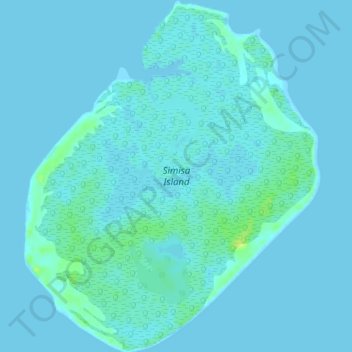
Name: Simisa Island topographic map, elevation, terrain.
Location: Simisa Island, Banguingui, Sulu, Bangsamoro, Philippines (5.93222 121.55745 5.97957 121.59753)
Average elevation: 2 m
Minimum elevation: -1 m
Maximum elevation: 14 m
Thank you for supporting this site ❤️
Make a donation
Make a donation