
Thank you for supporting this site ❤️
Make a donation
Make a donation
Karagöl Dağı topographic map
Click on the map to display elevation.
Thank you for supporting this site ❤️
Make a donation
Make a donation
About this map
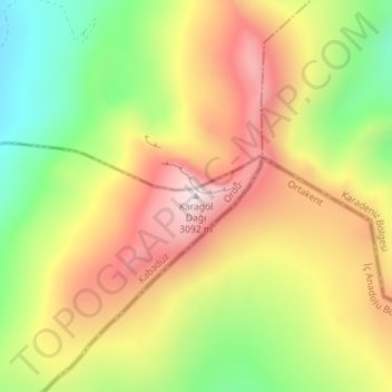
Name: Karagöl Dağı topographic map, elevation, terrain.
Location: Karagöl Dağı, Kabadüz, Ordu, Black Sea Region, Turkey (40.52211 38.15357 40.52221 38.15367)
Average elevation: 2,784 m
Minimum elevation: 2,448 m
Maximum elevation: 3,106 m
Thank you for supporting this site ❤️
Make a donation
Make a donation
Other topographic maps
Click on a map to view its topography, its elevation and its terrain.