Geolocate

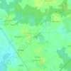
Croix Izan topographic map

Click on the map to display elevation.

About this map

Name: Croix Izan topographic map, elevation, terrain.

Location: Croix Izan, Erdeven, Lorient, Morbihan, Bretagne, France métropolitaine, 56410, France (47.63468 -3.21071 47.67468 -3.17071)

Average elevation: 9 m

Minimum elevation: -4 m

Maximum elevation: 19 m

Other topographic maps

Click on a map to view its topography, its elevation and its terrain.
Quadrilatère de Crucuno

France > Bretagne > Morbihan > Erdeven > Crucuno

Average elevation: 18 m

56410

France > Bretagne > Morbihan > Erdeven

Average elevation: 13 m