
Chatham County topographic map
Interactive map
Click on the map to display elevation.
About this map
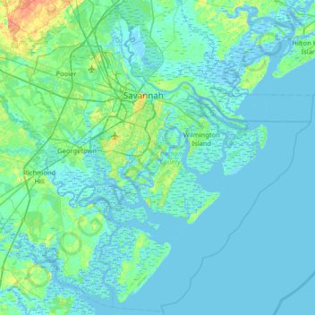
Name: Chatham County topographic map, elevation, terrain.
Location: Chatham County, Georgia, USA (31.70520 -81.39170 32.23759 -80.75143)
Average elevation: 3 m
Minimum elevation: -5 m
Maximum elevation: 28 m
Other topographic maps
Click on a map to view its topography, its elevation and its terrain.