
Thank you for supporting this site ❤️
Make a donation
Make a donation
San Raymundo topographic map
Click on the map to display elevation.
Thank you for supporting this site ❤️
Make a donation
Make a donation
About this map
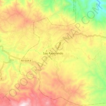
Name: San Raymundo topographic map, elevation, terrain.
Location: San Raymundo, Guatemala Department, Guatemala (14.72410 -90.63494 14.80410 -90.55494)
Average elevation: 1,562 m
Minimum elevation: 1,130 m
Maximum elevation: 1,948 m
Thank you for supporting this site ❤️
Make a donation
Make a donation