
Thank you for supporting this site ❤️
Make a donation
Make a donation
Linden topographic map
Click on the map to display elevation.
Thank you for supporting this site ❤️
Make a donation
Make a donation
About this map
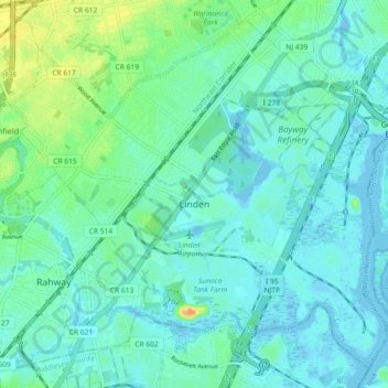
Name: Linden topographic map, elevation, terrain.
Location: Linden, Union County, New Jersey, United States (40.59264 -74.29070 40.65493 -74.19959)
Average elevation: 8 m
Minimum elevation: -4 m
Maximum elevation: 37 m
Thank you for supporting this site ❤️
Make a donation
Make a donation
Other topographic maps
Click on a map to view its topography, its elevation and its terrain.