
Thank you for supporting this site ❤️
Make a donation
Make a donation
Lost City topographic map
Click on the map to display elevation.
Thank you for supporting this site ❤️
Make a donation
Make a donation
About this map
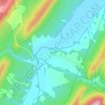
Name: Lost City topographic map, elevation, terrain.
Location: Lost City, Hardy County, West Virginia, 26810, United States (38.91076 -78.85383 38.95076 -78.81383)
Average elevation: 506 m
Minimum elevation: 419 m
Maximum elevation: 761 m
Thank you for supporting this site ❤️
Make a donation
Make a donation
Other topographic maps
Click on a map to view its topography, its elevation and its terrain.