
Thank you for supporting this site ❤️
Make a donation
Make a donation
Verrenberg topographic map
Click on the map to display elevation.
Thank you for supporting this site ❤️
Make a donation
Make a donation
About this map
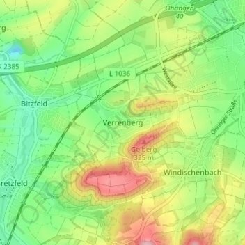
Name: Verrenberg topographic map, elevation, terrain.
Average elevation: 250 m
Minimum elevation: 179 m
Maximum elevation: 357 m
Thank you for supporting this site ❤️
Make a donation
Make a donation
Other topographic maps
Click on a map to view its topography, its elevation and its terrain.
74613
Deutschland > Baden-Württemberg > Hohenlohekreis > Öhringen > Büttelbronn
Average elevation: 277 m
Thank you for supporting this site ❤️
Make a donation
Make a donation