
Seelisberg topographic map
Interactive map
Click on the map to display elevation.
About this map
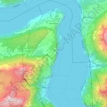
Name: Seelisberg topographic map, elevation, terrain.
Location: Seelisberg, Uri, 6377, Zwitserland (46.92260 8.54357 46.99341 8.60439)
Average elevation: 797 m
Minimum elevation: 414 m
Maximum elevation: 2,088 m