
Murg topographic map
Interactive map
Click on the map to display elevation.
About this map
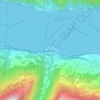
Name: Murg topographic map, elevation, terrain.
Location: Murg, Quarten, Wahlkreis Sarganserland, Saint-Gall, 8877, Suisse (47.09373 9.19505 47.13373 9.23505)
Average elevation: 617 m
Minimum elevation: 418 m
Maximum elevation: 1,441 m