
Thank you for supporting this site ❤️
Make a donation
Make a donation
Johnston topographic map
Click on the map to display elevation.
Thank you for supporting this site ❤️
Make a donation
Make a donation
About this map
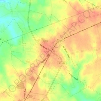
Name: Johnston topographic map, elevation, terrain.
Location: Johnston, Edgefield County, South Carolina, United States (33.81432 -81.82772 33.85025 -81.78514)
Average elevation: 190 m
Minimum elevation: 159 m
Maximum elevation: 207 m
Thank you for supporting this site ❤️
Make a donation
Make a donation
Other topographic maps
Click on a map to view its topography, its elevation and its terrain.