
Thank you for supporting this site ❤️
Make a donation
Make a donation
Ezel topographic map
Click on the map to display elevation.
Thank you for supporting this site ❤️
Make a donation
Make a donation
About this map
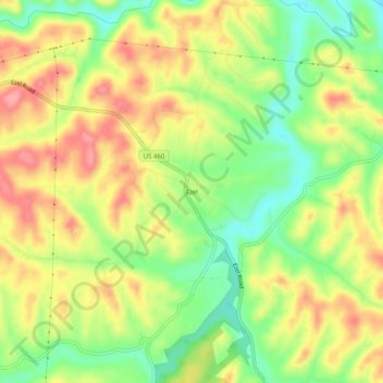
Name: Ezel topographic map, elevation, terrain.
Location: Ezel, Morgan County, Kentucky, 41425, United States (37.87120 -83.46435 37.91120 -83.42435)
Average elevation: 292 m
Minimum elevation: 241 m
Maximum elevation: 341 m
Thank you for supporting this site ❤️
Make a donation
Make a donation
Other topographic maps
Click on a map to view its topography, its elevation and its terrain.