
Thank you for supporting this site ❤️
Make a donation
Make a donation
Monteiasi topographic map
Click on the map to display elevation.
Thank you for supporting this site ❤️
Make a donation
Make a donation
About this map
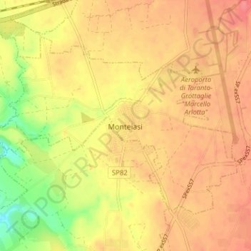
Name: Monteiasi topographic map, elevation, terrain.
Location: Monteiasi, Taranto, Puglia, Italia (40.48295 17.34613 40.51694 17.40914)
Average elevation: 52 m
Minimum elevation: 10 m
Maximum elevation: 74 m
Thank you for supporting this site ❤️
Make a donation
Make a donation
Other topographic maps
Click on a map to view its topography, its elevation and its terrain.