
Kentucky topographic map
Interactive map
Click on the map to display elevation.
About this map
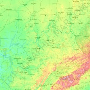
Name: Kentucky topographic map, elevation, terrain.
Location: Kentucky, Estados Unidos (36.49672 -89.57151 39.14780 -81.96454)
Average elevation: 302 m
Minimum elevation: 92 m
Maximum elevation: 1,920 m