
Sungai Mengkibol topographic map
Interactive map
Click on the map to display elevation.
About this map
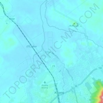
Name: Sungai Mengkibol topographic map, elevation, terrain.
Location: Sungai Mengkibol, Kluang, Johor, Malaysia (2.02344 103.30313 2.10932 103.32366)
Average elevation: 37 m
Minimum elevation: 16 m
Maximum elevation: 429 m