
Hochart topographic map
Interactive map
Click on the map to display elevation.
About this map
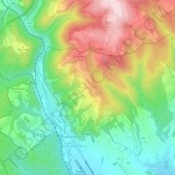
Name: Hochart topographic map, elevation, terrain.
Average elevation: 536 m
Minimum elevation: 396 m
Maximum elevation: 744 m
Other topographic maps
Click on a map to view its topography, its elevation and its terrain.
Burgenlandsiedlung
Österreich > Burgenland > Bezirk Oberwart > Gemeinde Pinkafeld > Pinkafeld Nord
Burgenlandsiedlung, Pinkafeld Nord, Gemeinde Pinkafeld, Bezirk Oberwart, Burgenland, 7423, Österreich
Average elevation: 488 m