
Thank you for supporting this site ❤️
Make a donation
Make a donation
Maddaloni topographic map
Click on the map to display elevation.
Thank you for supporting this site ❤️
Make a donation
Make a donation
About this map
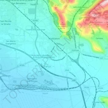
Name: Maddaloni topographic map, elevation, terrain.
Location: Maddaloni, Caserta, Campania, 81024, Italy (40.99707 14.34253 41.05934 14.44933)
Average elevation: 85 m
Minimum elevation: 18 m
Maximum elevation: 507 m
Thank you for supporting this site ❤️
Make a donation
Make a donation
Other topographic maps
Click on a map to view its topography, its elevation and its terrain.