
Verdrel topographic map
Interactive map
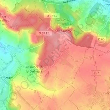
Click on the map to display elevation.
About this map
Name: Verdrel topographic map, elevation, terrain.
Average elevation: 146 m
Minimum elevation: 80 m
Maximum elevation: 191 m
Other topographic maps
Click on a map to view its topography, its elevation and its terrain.
Olhain
France > Hauts-de-France > Pas-de-Calais > Fresnicourt-le-Dolmen
Olhain, Fresnicourt-le-Dolmen, Béthune, Pas-de-Calais, Hauts-de-France, France métropolitaine, 62150, France
Average elevation: 127 m
Château d'Olhain
France > Hauts-de-France > Pas-de-Calais > Fresnicourt-le-Dolmen > Olhain
Château d'Olhain, Rue Léo Lagrange, Olhain, Fresnicourt-le-Dolmen, Béthune, Pas-de-Calais, Hauts-de-France, France métropolitaine, 62150, France
Average elevation: 116 m