
如意乡 topographic map
Interactive map
Click on the map to display elevation.
About this map
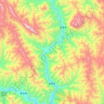
Name: 如意乡 topographic map, elevation, terrain.
Location: 如意乡, 卡若区 མཁར་རོ་ཆུས།, 昌都市 ཆབ་མདོ་ས་ཁུལ།, Tibet, China (31.15352 97.01049 31.45328 97.31859)
Average elevation: 4,106 m
Minimum elevation: 3,227 m
Maximum elevation: 5,412 m