
Thank you for supporting this site ❤️
Make a donation
Make a donation
Medgidia topographic map
Click on the map to display elevation.
Thank you for supporting this site ❤️
Make a donation
Make a donation
About this map
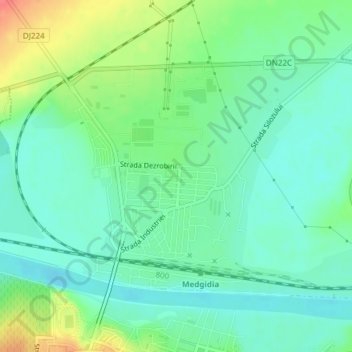
Name: Medgidia topographic map, elevation, terrain.
Location: Medgidia, Constanța, Romania (44.25039 28.25431 44.26825 28.27865)
Average elevation: 21 m
Minimum elevation: 2 m
Maximum elevation: 61 m
Thank you for supporting this site ❤️
Make a donation
Make a donation
Other topographic maps
Click on a map to view its topography, its elevation and its terrain.
Techirghiol
Town is in the south east extremity of Romania (Constanța County), situated on the north west shore of Lake Techirghiol (11.6 km2), elevation 15–20 m, 18 km south of the municipality of Constanța and very close to the Black Sea (3 km).
Average elevation: 23 m
Thank you for supporting this site ❤️
Make a donation
Make a donation