
Pittsburg Landing topographic map
Interactive map
Click on the map to display elevation.
About this map
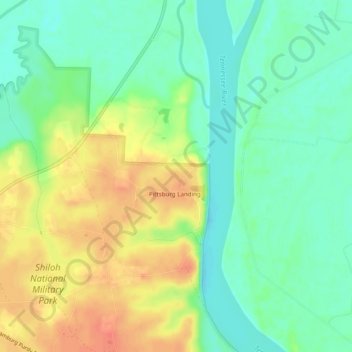
Name: Pittsburg Landing topographic map, elevation, terrain.
Location: Pittsburg Landing, Hardin County, Tennessee, USA (35.13231 -88.34282 35.17231 -88.30282)
Average elevation: 127 m
Minimum elevation: 107 m
Maximum elevation: 153 m
Other topographic maps
Click on a map to view its topography, its elevation and its terrain.
Shiloh National
USA > Tennessee > Pittsburg Landing
Shiloh National, Pittsburg Landing, Hardin County, Tennessee, USA
Average elevation: 134 m