
Neerlanden topographic map
Interactive map
Click on the map to display elevation.
About this map
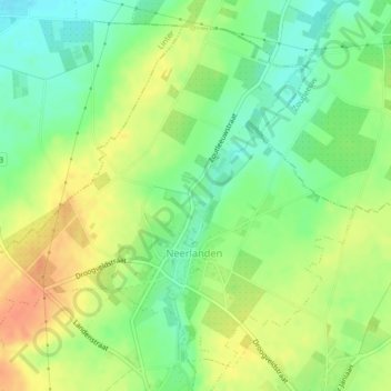
Name: Neerlanden topographic map, elevation, terrain.
Location: Neerlanden, Landen, Louvain, Brabant flamand, Flandre, Belgique (50.77033 5.05507 50.79385 5.09672)
Average elevation: 60 m
Minimum elevation: 39 m
Maximum elevation: 83 m
Other topographic maps
Click on a map to view its topography, its elevation and its terrain.
Overwinden
Overwinden, Landen, Louvain, Brabant flamand, Flandre, Belgique
Average elevation: 83 m