
Thank you for supporting this site ❤️
Make a donation
Make a donation
Landersdale topographic map
Click on the map to display elevation.
Thank you for supporting this site ❤️
Make a donation
Make a donation
About this map
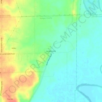
Name: Landersdale topographic map, elevation, terrain.
Location: Landersdale, Morgan County, Indiana, 46183, United States (39.59949 -86.28305 39.63949 -86.24305)
Average elevation: 211 m
Minimum elevation: 194 m
Maximum elevation: 240 m
Thank you for supporting this site ❤️
Make a donation
Make a donation
Other topographic maps
Click on a map to view its topography, its elevation and its terrain.