
The Cotswolds AONB topographic map
Interactive map
Click on the map to display elevation.
About this map
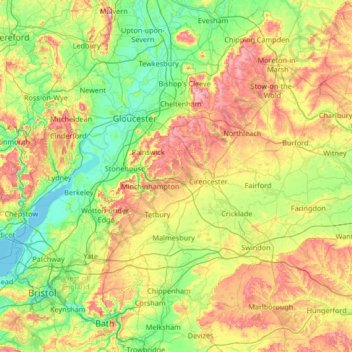
Name: The Cotswolds AONB topographic map, elevation, terrain.
Average elevation: 107 m
Minimum elevation: -1 m
Maximum elevation: 419 m
Other topographic maps
Click on a map to view its topography, its elevation and its terrain.
Alderley
United Kingdom > England > Stroud > Alderley
Alderley, Stroud, Gloucestershire, South West England, England, GL12 7, United Kingdom
Average elevation: 103 m