
Wallenried topographic map
Interactive map
Click on the map to display elevation.
About this map
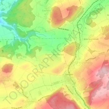
Name: Wallenried topographic map, elevation, terrain.
Location: Wallenried, Essert, District du Lac, Fribourg, 1784, Suisse (46.85432 7.09467 46.89432 7.13467)
Average elevation: 576 m
Minimum elevation: 460 m
Maximum elevation: 677 m