
Make a donation
Mount Tammany topographic map
Click on the map to display elevation.
Make a donation
Mount Tammany
Hiking on Mount Tammany consists of two trails. The red dot trail and the blue dot trail. The red dot trail is 1.2 miles and the blue dot trail is 1.8 miles. Combining the two for one of NJ's most popular hikes is a 3 mile loop. There is a 1201 feet elevation change going up and down the mountain. Generally, this is considered a challenging trail with an average completion time of 2 hours 20 minutes. Climbing up the trail also requires bouldering and physical climbing at some points along the trail. Recommended equipment, comfortable, active footwear, water, appropriate clothing for physical activity. For more information including a detailed analysis of the hike itself, please visit these links below where experienced hikers provide their insight.
Make a donation
About this map
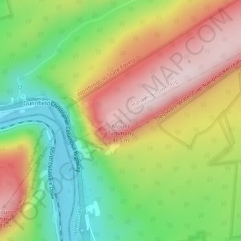
Name: Mount Tammany topographic map, elevation, terrain.
Average elevation: 267 m
Minimum elevation: 81 m
Maximum elevation: 465 m
Make a donation