
Thank you for supporting this site ❤️
Make a donation
Make a donation
Abilene topographic map
Click on the map to display elevation.
Thank you for supporting this site ❤️
Make a donation
Make a donation
About this map
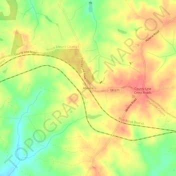
Name: Abilene topographic map, elevation, terrain.
Location: Abilene, Charlotte County, Virginia, United States (37.12154 -78.56416 37.16154 -78.52416)
Average elevation: 167 m
Minimum elevation: 131 m
Maximum elevation: 194 m
Thank you for supporting this site ❤️
Make a donation
Make a donation
Other topographic maps
Click on a map to view its topography, its elevation and its terrain.