
6713 topographic map
Interactive map
Click on the map to display elevation.
About this map
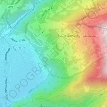
Name: 6713 topographic map, elevation, terrain.
Location: 6713, Gemeinde Ludesch, Bezirk Bludenz, Vorarlberg, Oostenrijk (47.19381 9.79542 47.19391 9.79552)
Average elevation: 799 m
Minimum elevation: 532 m
Maximum elevation: 1,319 m