
Münsingen topographic map
Interactive map
Click on the map to display elevation.
About this map
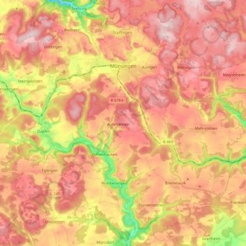
Name: Münsingen topographic map, elevation, terrain.
Average elevation: 745 m
Minimum elevation: 556 m
Maximum elevation: 862 m
Other topographic maps
Click on a map to view its topography, its elevation and its terrain.
Wanne
Allemagne > Bade-Wurtemberg > Landkreis Reutlingen > Pfullingen
Wanne, Pfullingen, Landkreis Reutlingen, Bade-Wurtemberg, 72793, Allemagne
Average elevation: 556 m
Pfullingen
Allemagne > Bade-Wurtemberg > Landkreis Reutlingen
Pfullingen, Landkreis Reutlingen, Bade-Wurtemberg, 72793, Allemagne
Average elevation: 565 m
Trochtelfingen
Allemagne > Bade-Wurtemberg > Landkreis Reutlingen
Trochtelfingen, Hohenstein, Landkreis Reutlingen, Bade-Wurtemberg, 72818, Allemagne
Average elevation: 764 m