
Thank you for supporting this site ❤️
Make a donation
Make a donation
Kitare topographic map
Click on the map to display elevation.
Thank you for supporting this site ❤️
Make a donation
Make a donation
About this map
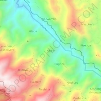
Name: Kitare topographic map, elevation, terrain.
Location: Kitare, Rubanda, Western Region, Uganda (-1.03072 29.76116 -0.99072 29.80116)
Average elevation: 1,885 m
Minimum elevation: 1,511 m
Maximum elevation: 2,349 m
Thank you for supporting this site ❤️
Make a donation
Make a donation
Other topographic maps
Click on a map to view its topography, its elevation and its terrain.