
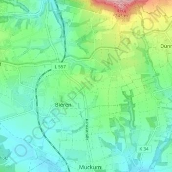
Höge topographic map
Interactive map
Click on the map to display elevation.
About this map
Name: Höge topographic map, elevation, terrain.
Average elevation: 114 m
Minimum elevation: 71 m
Maximum elevation: 238 m
Other topographic maps
Click on a map to view its topography, its elevation and its terrain.
Rödinghausen
Deutschland > Nordrhein-Westfalen > Kreis Herford > Rödinghausen
Rödinghausen, Kreis Herford, Nordrhein-Westfalen, Deutschland
Average elevation: 152 m
Ostkilver
Deutschland > Nordrhein-Westfalen > Kreis Herford > Rödinghausen
Ostkilver, Rödinghausen, Kreis Herford, Nordrhein-Westfalen, 32289, Deutschland
Average elevation: 94 m
Bruchmühlen
Deutschland > Nordrhein-Westfalen > Kreis Herford > Rödinghausen
Bruchmühlen, Rödinghausen, Kreis Herford, Nordrhein-Westfalen, Deutschland
Average elevation: 95 m