
Thank you for supporting this site ❤️
Make a donation
Make a donation
Orio Litta topographic map
Click on the map to display elevation.
Thank you for supporting this site ❤️
Make a donation
Make a donation
About this map
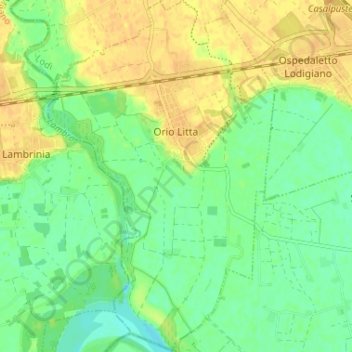
Name: Orio Litta topographic map, elevation, terrain.
Location: Orio Litta, Lodi, Lombardy, Italy (45.13158 9.53057 45.17736 9.57251)
Average elevation: 56 m
Minimum elevation: 42 m
Maximum elevation: 69 m
Thank you for supporting this site ❤️
Make a donation
Make a donation
Other topographic maps
Click on a map to view its topography, its elevation and its terrain.