
Thank you for supporting this site ❤️
Make a donation
Make a donation
Alajuela Province topographic map
Click on the map to display elevation.
Thank you for supporting this site ❤️
Make a donation
Make a donation
About this map
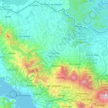
Name: Alajuela Province topographic map, elevation, terrain.
Location: Alajuela Province, Costa Rica (9.84012 -85.44670 11.08440 -84.16114)
Average elevation: 421 m
Minimum elevation: 0 m
Maximum elevation: 3,390 m
Thank you for supporting this site ❤️
Make a donation
Make a donation
Other topographic maps
Click on a map to view its topography, its elevation and its terrain.