
Thank you for supporting this site ❤️
Make a donation
Make a donation
Waushara County topographic map
Click on the map to display elevation.
Thank you for supporting this site ❤️
Make a donation
Make a donation
About this map
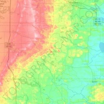
Name: Waushara County topographic map, elevation, terrain.
Location: Waushara County, Wisconsin, USA (43.98200 -89.59811 44.24578 -88.88587)
Average elevation: 283 m
Minimum elevation: 225 m
Maximum elevation: 394 m
Thank you for supporting this site ❤️
Make a donation
Make a donation