
Poljubinj topographic map
Interactive map
Click on the map to display elevation.
About this map
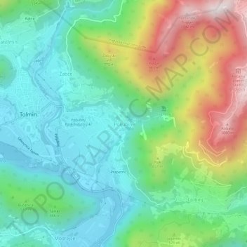
Name: Poljubinj topographic map, elevation, terrain.
Location: Poljubinj, 5220, Slowenien (46.16130 13.73524 46.20130 13.77524)
Average elevation: 464 m
Minimum elevation: 148 m
Maximum elevation: 1,148 m